The ancient and medieval world
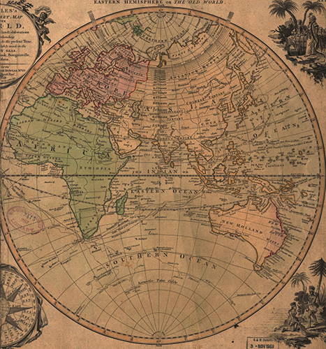
Excerpted from Bowles's New Pocket Map of the World (London, 1791)
Complete map available at the Library of Congress online
This map shows the world as it was known until the discovery of the Western Hemisphere. The map is recent (A.D. 1791, as you see above; Australia wasn’t discovered until A.D. 1660) but it is the world that earlier cartographers were working to chart. They knew it was a sphere; they understood the world to have one great sea in the middle (the Mediterranean) and a single, enormous ocean beyond the land masses. Just when the ancients discovered that the world was spherical depends in part on which culture and who you ask, but scholars with a need to know (sailors, mapmakers, astronomers, and astrologists) figured it out early. By the 4th century B.C. the Greeks had a very accurate estimate of the Earth's circumference, thanks to Euclid and his marvelous geometry. Columbus deliberately used a low-ball estimate of the distance in order to close a funding round and recruit sailors; in part, “oh, gee…we didn’t know how big it was” was a bit of Renaissance ass-covering by early explorers who knew better. But even the explorers did not expect the New World…they believed they would find open ocean and a few islands.

Copyright © The Curmudgeon's Guide™
All rights reserved